Coordinates and Time: Interactive Globe for Geography Lessons
Explore Earth's coordinate and time systems with an interactive globe. Learn about latitude, longitude, time zones, UTC, the International Date Line, and daylight conditions to enhance geography and navigation lessons.
Want to teach with this content in Prezuva Slide?
Prezuva — Create, Teach, Engage, Assess
Try for free →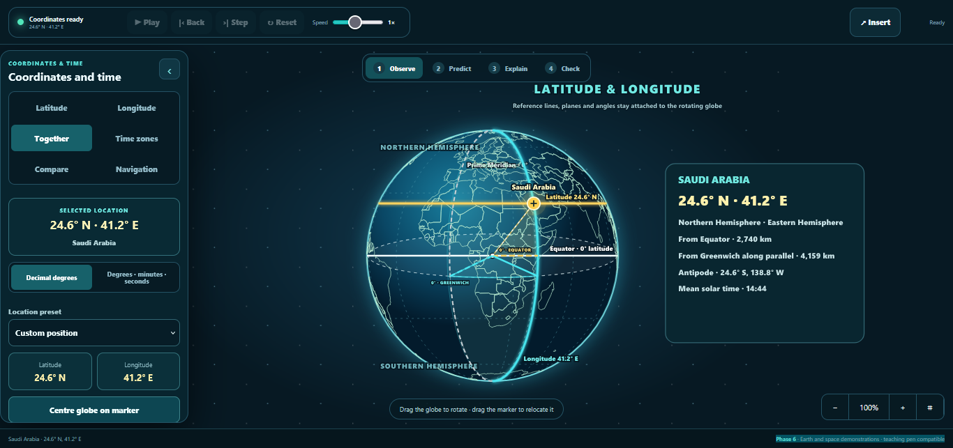
For individual learning only. Use for classroom teaching or commercial purposes is not permitted.
About this classroom tool
This classroom tool provides an interactive globe designed to help students explore Earth's coordinate and time systems. It visually demonstrates key geographical concepts such as latitude and longitude, hemispheres, and significant lines like the Equator and Prime Meridian.
Additionally, the tool covers time-related topics including time zones, Coordinated Universal Time (UTC), the International Date Line, and daylight conditions. It enables learners to compare locations, calculate local times, and visualise routes, making it ideal for geography, navigation, and general science lessons.
Key concepts
- Latitude and Longitude — the system of geographic coordinates used to locate any point on Earth’s surface.
- Hemispheres — the division of Earth into Northern, Southern, Eastern, and Western halves.
- Time Zones — regions of the Earth that have the same standard time, based on longitudinal divisions.
- Coordinated Universal Time (UTC) — the primary time standard by which the world regulates clocks and time.
- International Date Line — an imaginary line on the Earth’s surface defining the boundary where the date changes by one day.
- Daylight Conditions — the variation in sunlight experienced across different parts of the globe at any given time.
Using it in the classroom
- Starter activity: Introduce latitude and longitude by locating familiar places on the globe.
- Whole-class teaching: Demonstrate how time zones work and explain the concept of UTC and the International Date Line.
- Assessment for learning: Have students calculate local times for various cities using the globe’s time zone features.
- Homework: Assign students to compare daylight hours in different hemispheres and explain the reasons behind seasonal changes.
- Navigation lessons: Use the globe to visualise great-circle routes and calculate distances between locations.
Frequently asked questions
What are latitude and longitude?
Latitude and longitude are coordinate systems that allow us to pinpoint exact locations on Earth. Latitude lines run horizontally, while longitude lines run vertically.
How do time zones work?
Time zones divide the Earth into regions where the same standard time is used, generally based on longitudinal divisions, to account for the Earth's rotation and daylight.
What is the International Date Line?
The International Date Line is an imaginary line roughly along the 180° longitude where the date changes by one day when crossed.
Why do daylight hours vary around the world?
Daylight hours change due to the tilt of the Earth's axis and its orbit around the sun, causing different parts of the world to receive varying amounts of sunlight throughout the year.